Servicii Topografice

Oferim soluții precise pentru toate nevoile dumneavoastră în domeniul topografiei și măsurătorilor.

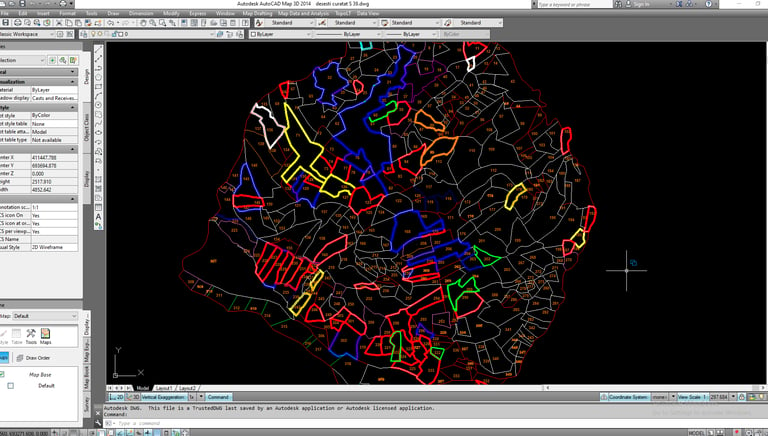
Măsurători pentru operatiuni cadastrale

Realizam masuratori topografice pentru a intocmi apoi documentatiile cadastrale cerute de clienti . Avand o baza de date bogata , executam orice tip de operatiune cadastrala
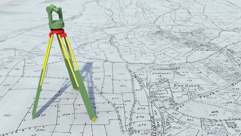
Planuri Topografice

Planul topografic este mijlocul prin care se prezinta situatia la zi a unei zone cu sau fara constructii , folosind aparatura de ultima generatie folosind semnele conventionale utilizandu-se apoi pentru proiectarea investitiilor .

Cadastru sistematic

Cadastrul sistematic reprezintă procesul prin care se realizează, pentru prima dată, identificarea, măsurarea, înregistrarea și înscrierea în sistemul integrat de cadastru și carte funciară a tuturor imobilelor (terenuri și construcții) dintr-o anumită unitate administrativ-teritorială sau zonă.

Relevee apartamente
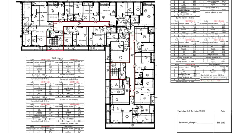
Releveul unui apartament reprezintă schița tehnică a acestuia, realizată pe baza măsurătorilor precise efectuate de un specialist topograf . Este un document important pentru diverse procese, cum ar fi întocmirea documentației cadastrale, vânzarea-cumpărarea, renovările sau obținerea autorizațiilor de construcție.
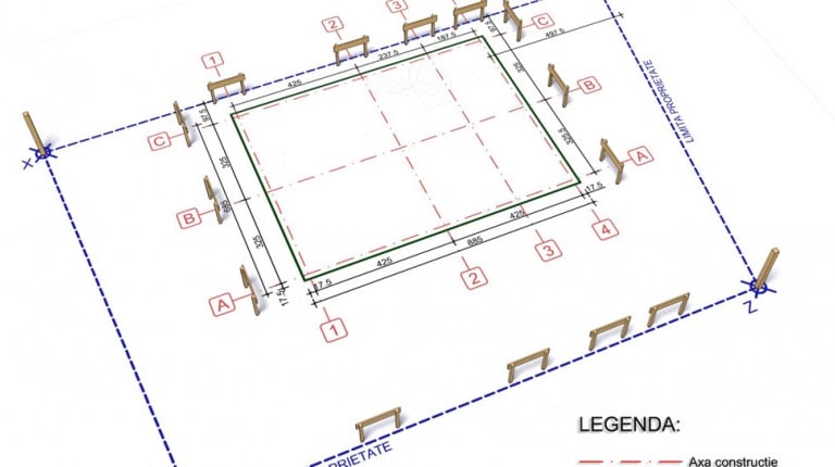
Trasare topografica

Trasarea topografică este un proces tehnic prin care elementele unui proiect (cum ar fi limitele unui teren, poziția construcțiilor, drumurilor, rețelelor de utilități etc.) sunt materializate pe teren, pe baza coordonatelor specificate în documentația tehnică. Este un pas esențial în implementarea unui proiect de construcție, asigurând precizia execuției în raport cu planurile aprobate.

Masuratori UAV
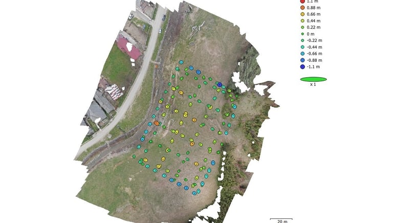
Măsurătorile UAV (Unmanned Aerial Vehicle) reprezintă utilizarea dronelor echipate cu tehnologii avansate (camere foto, senzori LiDAR, GPS de înaltă precizie) pentru colectarea datelor geospațiale. Aceste măsurători sunt utilizate în topografie, cadastru, agricultură, construcții, minerit și alte domenii pentru a genera modele detaliate ale terenului, a monitoriza lucrările sau a cartografia suprafețe mari într-un timp scurt.

Proiecte Topografice

Servicii precise pentru proiectele dumneavoastră de topografie.

A person wearing a white hard hat and high-visibility vest operates a surveying instrument, focusing intently on the task at hand. The background is blurred with hints of other construction activities or team members.
Măsurători Cadastrale

Expertiză în măsurători cadastrale pentru diverse industrii.

An aerial view of a vast landscape featuring a patchwork of fields, with variations in terrain, showing valleys and rivers. The land appears to be a mix of agricultural and natural areas, with roads and small buildings scattered throughout. The topography includes some elevated regions and woodland areas.
A table features a topographic map with detailed contours and vibrant colors. A knife with a wooden handle is placed nearby, next to a plastic water bottle. Sunlight casts dramatic shadows across the wooden surface, creating an adventurous atmosphere.
An aerial view of a dramatic and rugged landscape with ridges and valleys displaying intricate patterns. The image captures varying shades of green and brown, suggesting vegetation and bare earth. The topography features concentric circles and formations, possibly indicating geological activity or erosion over time.
Planuri Topografice

Creăm planuri topografice precise pentru proiectele dumneavoastră.

A detailed topographical map with green, blue, and brown areas indicating various terrain features such as forests, rivers, and elevations. The map is slightly crumpled, adding a textured appearance.

Galerie

Explorați proiectele noastre de topografie și inovație tehnologică.

A close-up view of a topographical map featuring a grid overlay. The map highlights the 'Emigrant Trail' and 'BLM' in bold text. There are marked trails with dashed lines and various geographical features such as contours and elevations.
Aerial view of a highly detailed geographical landscape, potentially a mountainous or volcanic region. Various water bodies in shades of blue are scattered across the terrain, surrounded by rugged hills, peaks, and valleys. The landscape features a mix of different textures, including rocky and potentially sandy areas, with a palette of colors ranging from earthy browns and greens to blues and grays.
A person wearing a high-visibility safety vest and a beanie stands outdoors, operating a theodolite mounted on a tripod. The background includes the facade of a residential building with balconies.
An aerial view of a vast, rugged terrain showing a combination of snow or ice-covered ground and brown earth. A geometrically shaped artificial structure, possibly a pond or mining pit, is visible, filled with liquid of different colors. There are scattered clouds casting shadows on the landscape below.
A satellite image of a mountain surrounded by lush green vegetation. The mountain features a clearly defined crater and is situated near a coastline with dark blue waters. The topography of the landscape shows various textures, indicating different land uses or types of vegetation.